Looking for design inspiration?   Browse our curated collections!

Previous Image

|

Next Image
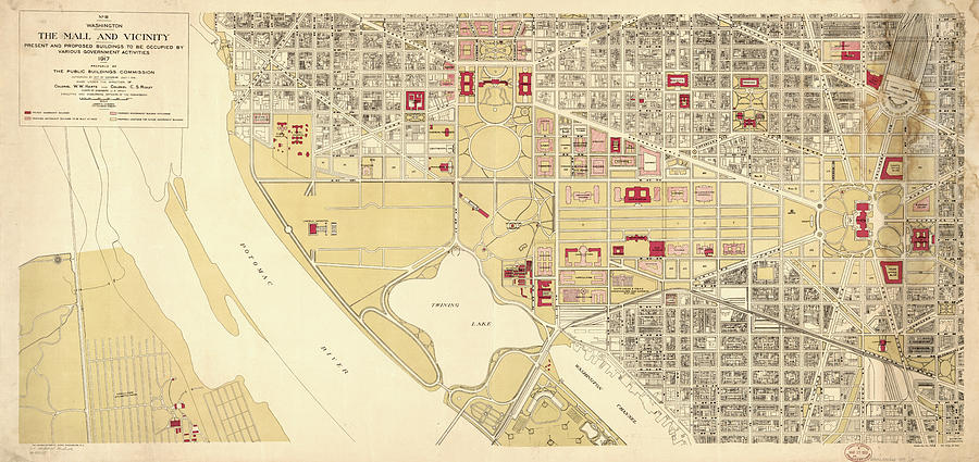
Washington D.c. Drawing - Vintage Map of The Washington D.C. Mall - 1917 by CartographyAssociates

Vintage Map of The Washington D.C. Mall - 1917 is a drawing by CartographyAssociates which was uploaded on September 15th, 2016.

More from CartographyAssociates

View Profile

Vintage Pictorial Map of Washington D.C. - 1871 by CartographyAssociates
Vintage Map of Washington D.C. Battlefields - 1862 by CartographyAssociates
Vintage Map of Washington D.C.  #1 by CartographyAssociates
Vintage Map of Washington D.C. - 1793 by CartographyAssociates
Washington DC Aerial Photograph by PhotographyAssociates
Vintage Map of Washington D.C.  by CartographyAssociates
Vintage Map of Washington D.C. - 1909 by CartographyAssociates
Vintage Map of Washington D.C. - 1794 by CartographyAssociates
Vintage Washington D.C. Capitol Hill Map - 1815 by CartographyAssociates
Vintage Map of Washington D.C. - 1815 by CartographyAssociates
Vintage Map of Washington D.C. - 1820 by CartographyAssociates
Vintage Pictorial Map of Washington D.C. - 1916 by CartographyAssociates
Vintage Pictorial Map of Washington D.C. - 1872 by CartographyAssociates
Vintage Pictorial Map of Washington D.C. - 1901 by CartographyAssociates
Vintage Pictorial Map of Washington D.C. - 1921 by CartographyAssociates
Federal Triangle Washington D.C. by PhotographyAssociates
Vintage Aqueduct of Georgetown Map  by CartographyAssociates

Comments (1)

Nyunga Teghah

Nyunga Teghah

Congratulations

Recently Viewed

Vintage Map of The Washington D.C. Mall - 1917 by CartographyAssociates
Previous Image Next Image