Looking for design inspiration?   Browse our curated collections!

Previous PagePREV

|

1 of 5000

|

NEXTNext Page
Pinkerton's Extraordinary 1818 Map Of The Austrian Dominions. Covers The Austro-hungarian Empire At The Height Of Its Influence. Includes Bohemia Tank Top featuring the photograph 1818 Pinkerton Map of the Austrian Empire by Paul Fearn

The watermark at the lower right corner of the image will not appear on the final product.
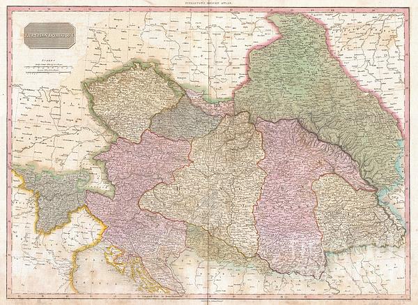
Share This Page

1818 Pinkerton Map of the Austrian Empire Tank Top

$28.00

Style

Description

Size

Size Chart

Color

 
White

Image Size


Product Details

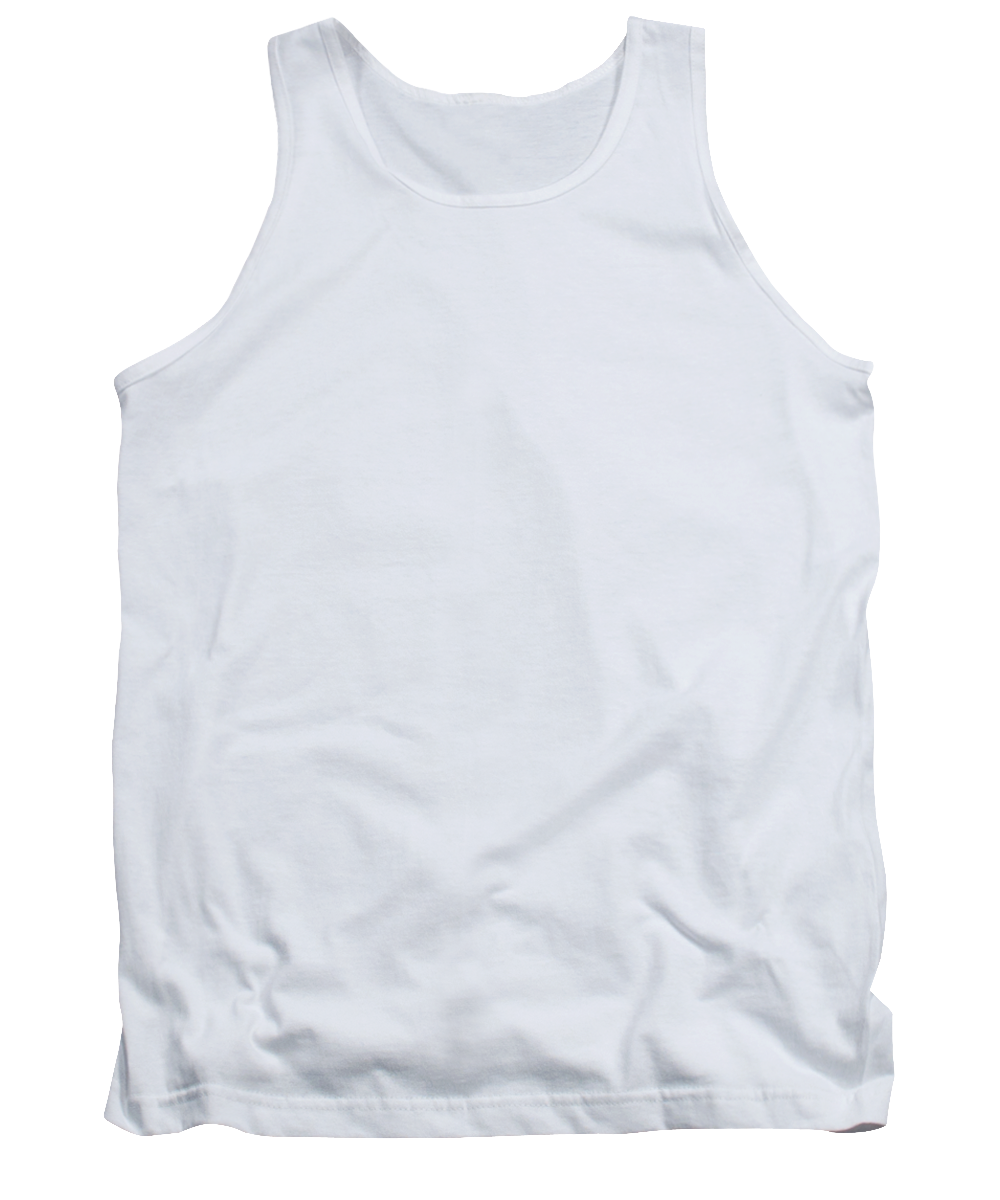
Our tank tops are made from a 50% cotton / 50% polyester blend and are available in five different sizes.   All tank tops are machine washable.

Design Details

Pinkerton's extraordinary 1818 map of the Austrian Dominions. Covers the Austro-Hungarian Empire at the height of its influence. Includes Bohemia,... more

Ships Within

1 - 2 business days

You May Also Like

1878 Bien and Johnson Map of New York City Manhattan Island During the Revolutionary War Tank Top by Paul Fearn
1827 Finley Map of Mississippi Tank Top by Paul Fearn
Coast Survey Map of the Chesapeake Bay  Tank Top by Paul Fearn
1778 Sartine Map of Georgia North Carolina South Carolina Virginia and Maryland Tank Top by Paul Fearn
1777 Brion de La Tour Map of New York and New England Revolutionary War Tank Top by Paul Fearn
1778 Bellin Nautical Chart or Map of the World Tank Top by Paul Fearn
Coast Survey Chart or Map of the Chesapeake Bay Tank Top by Paul Fearn
1855 Colton Map of Texas Tank Top by Paul Fearn
1857 Colton Travellers Map of Long Island New York Tank Top by Paul Fearn
 A truly fascinating 1772 map of the northwestern parts of North America by Robert de Vaugondy and T Tank Top by Paul Fearn
1773 Bellin Map of the Cape of Good Hope Capetown South Africa Tank Top by Paul Fearn
1852 Levasseur Map of the Department De La Vendee France Fiefs Vendeens Wines Tank Top by Paul Fearn
1865 Spruner Map of Greece, Macedonia and Thrace before the Peloponnesian War Tank Top by Paul Fearn
1772 Vaugondy  Diderot Map of North America and the Northwest Passage Tank Top by Paul Fearn
1853 US Coast Survey Map of the Western Florida Panhandle Tank Top by Paul Fearn
1855 Colton Map of Alabama Tank Top by Paul Fearn
1855 Colton Map of Denmark Tank Top by Paul Fearn
1854 Colton Pocket Map of Ohio Michigan Wisconsin Iowa Illinois Missouri Indiana and Kentucky  Tank Top by Paul Fearn
1855 Spruner Map of Asia under the Mongol Empire  Tank Top by Paul Fearn
1780 Raynal and Bonne Map of Antilles Islands Tank Top by Paul Fearn
More Tank Tops from Paul Fearn

Additional Products

1818 Pinkerton Map of the Austrian Empire Photograph by Paul Fearn

Photograph

1818 Pinkerton Map Of The Austrian Empire Canvas Print

Canvas Print

1818 Pinkerton Map Of The Austrian Empire Framed Print

Framed Print

1818 Pinkerton Map Of The Austrian Empire Art Print

Art Print

1818 Pinkerton Map Of The Austrian Empire Poster

Poster

1818 Pinkerton Map Of The Austrian Empire Metal Print

Metal Print

1818 Pinkerton Map Of The Austrian Empire Acrylic Print

Acrylic Print

1818 Pinkerton Map Of The Austrian Empire Wood Print

Wood Print

1818 Pinkerton Map Of The Austrian Empire Greeting Card

Greeting Card

1818 Pinkerton Map Of The Austrian Empire iPhone Case

iPhone Case

1818 Pinkerton Map Of The Austrian Empire Throw Pillow

Throw Pillow

1818 Pinkerton Map Of The Austrian Empire Duvet Cover

Duvet Cover

1818 Pinkerton Map Of The Austrian Empire Shower Curtain

Shower Curtain

1818 Pinkerton Map Of The Austrian Empire Tote Bag

Tote Bag

1818 Pinkerton Map Of The Austrian Empire Round Beach Towel

Round Beach Towel

1818 Pinkerton Map Of The Austrian Empire Zip Pouch

Zip Pouch

1818 Pinkerton Map Of The Austrian Empire Beach Towel

Beach Towel

1818 Pinkerton Map Of The Austrian Empire Weekender Tote Bag

Weekender Tote Bag

1818 Pinkerton Map Of The Austrian Empire Portable Battery Charger

Portable Battery Charger

1818 Pinkerton Map Of The Austrian Empire Bath Towel

Bath Towel

1818 Pinkerton Map Of The Austrian Empire T-Shirt

Apparel

1818 Pinkerton Map Of The Austrian Empire Coffee Mug

Coffee Mug

Tank Top Tags

tank tops abstract tank tops vintage tank tops map tank tops castle tank tops globe tank tops

Photograph Tags

photographs abstract photos vintage photos map photos castle photos globe photos

Comments (1)

Sergey Taran

Sergey Taran

I love it )

Tank Top Reviews (139)

Average Rating (4 Stars):

Star Rating Full Star Rating Full Star Rating Full Star Rating Full Star Rating Empty

Lana Christian

April 17th, 2024

Star Rating Full Star Rating Full Star Rating Full Star Rating Full Star Rating Full
Product Review Image

It came in different color than advertised. Instead of Red it is grayish pink.

Lana Christian

April 17th, 2024

Star Rating Full Star Rating Full Star Rating Full Star Rating Full Star Rating Full
Product Review Image

Came in different color than Advertised. Instead of navy blue, it is bluish gray.

Kevin Stirzaker

April 11th, 2024

Star Rating Full Star Rating Full Star Rating Full Star Rating Full Star Rating Full
Product Review Image

Still waiting for my order 😪

Marianne Obrzut

April 10th, 2024

Star Rating Full Star Rating Full Star Rating Full Star Rating Full Star Rating Full
Product Review Image

We have always been Cleveland Indians fans. I bought this tank for my son. Great tank & many compliments.

Norma Davis

October 18th, 2023

Star Rating Full Star Rating Full Star Rating Full Star Rating Full Star Rating Empty
Product Review Image

t-shirt material was OK

Agostino Raimondi

July 23rd, 2023

Star Rating Full Star Rating Full Star Rating Full Star Rating Empty Star Rating Empty
Product Review Image

Like the logo but not the tank top so much it rides to low at the front and the back.

Artist's Description

Pinkerton's extraordinary 1818 map of the Austrian Dominions. Covers the Austro-Hungarian Empire at the height of its influence. Includes Bohemia, Tyrol, Austria, Croatia, Sclavonia, Hungary, Transylvania, and parts of Poland. Offers considerable detail with political divisions and color coding at the regional level. Identifies cities, towns, castles, important battle sites, castles, swamps, mountains and river ways. Title plate in the upper left quadrant. Two mile scales, in German and British Statute Miles, also appear in the upper left quadrant. Drawn by L. Herbert and engraved by Samuel Neele under the direction of John Pinkerton. This map comes from the scarce American edition of Pinkerton’s Modern Atlas, published by Thomas Dobson & Co. of Philadelphia in 1818.

About Paul Fearn

Paul Fearn

My passion is Photography and Aviation or is that Aviation and Photography ! I hope you enjoy my photographs.

Shop with Confidence

Satisfaction Guarantee

Our return policy is very simple:


If you're not happy with a purchase that you made on Pixels.com, for any reason, you can return it to us within 30 days of the order date.   As soon as it arrives, we'll issue a full refund for the entire purchase price.   Please note - Pixels does not reimburse the outgoing or return shipping charges unless the return is due to a defect in quality.


Pixels sells thousands of pieces of artwork each month - all with a 100% money-back guarantee.   We take great pride in the fact that hundreds of thousands of artists have chosen Pixels to fulfill their orders, and we look forward to helping you select your next piece!

Delivery

All tank tops ship from our production facility within 1 - 2 business days of your order.


$28.00