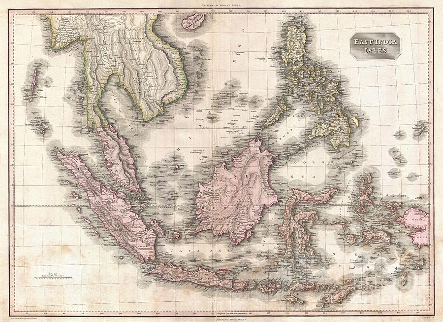
1818 Pinkerton Map of the East Indies and Southeast Asia is a photograph by Paul Fearn which was uploaded on October 17th, 2013.
1818 Pinkerton Map of the East Indies and Southeast Asia
Truly a masterwork of copperplate engraving, this is Pinkerton's extraordinary 1818 map of the East Indies. Covers from Burma south to Java and from... more

by Paul Fearn
Title
1818 Pinkerton Map of the East Indies and Southeast Asia
Artist
Paul Fearn
Medium
Photograph
Description
Truly a masterwork of copperplate engraving, this is Pinkerton's extraordinary 1818 map of the East Indies. Covers from Burma south to Java and from the Andaman Islands eastward as far as the Philippines and New Guinea. Includes the entire Malay Peninsula, much of Southeast Asia (Thailand, Cambodia, Vietnam), Sumatra, Java, Borneo and the Philippines. Pinkerton offers impressive detail throughout noting indigenous groups, forts, towns and cities, swamps, mountains, and river systems. Known regions such as Java and Sumatra are full of interesting notes and commentary, such as the sites of various gold mines, plantations, notes on river navigation, and comments on the terrain. Lesser known areas, such as New Guinea and the interior of Borneo, often feature simpler comments suchas Fresh Water or Lava. The island of Singapore, spelled Sincapoor is identified. The island of Rakata, spelled Rakama, where Krakatoa famously erupted in 1883, destroying the island in its entirety, is also identified. Further identifies the important centers of Siam, Bangkok, Malacca, Pegu, Rangoon, Manila, etc. Possibly the finest mapping of the region to appear in the 19th century. Drawn by L. Herbert and engraved by Samuel Neele under the direction of John Pinkerton. This map comes from the scarce American edition of Pinkerton’s Modern Atlas, published by Thomas Dobson & Co. of Philadelphia in 1818.
Uploaded
October 17th, 2013
More from Paul Fearn
Comments
There are no comments for 1818 Pinkerton Map of the East Indies and Southeast Asia. Click here to post the first comment.


