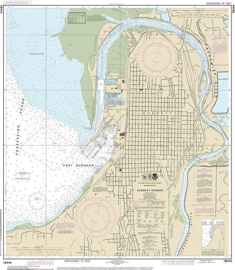
Everett Harbor Nautical Chart 18444 is a piece of digital artwork by John Gernatt which was uploaded on July 24th, 2022.
Everett Harbor Nautical Chart 18444
This is NOAA’s chart number 18444, based on the original, traditional paper nautical chart. It covers a section of Washington State’s coast.... more

by John Gernatt
Title
Everett Harbor Nautical Chart 18444
Artist
John Gernatt
Medium
Digital Art
Description
This is NOAA’s chart number 18444, based on the original, traditional paper nautical chart. It covers a section of Washington State’s coast. Coverage focuses on Everett Harbor and the immediate vicinity. The chart’s scale is 1:10,000 At Lat. 47°59’N. This chart covers fewer areas with better-detailed information than navigation charts with a scale of 1:80,000. Color shading on the chart indicates various water depths and land elevations. Depth soundings are in feet. Also included on the chart are aids and hazards to navigation. Typically, mariners use nautical charts covering this map scale for harbor and inshore navigation. NOAA is phasing out this paper chart and others like it. The phase-out completion date for all paper charts is January 2025. Electronic charts for onboard navigation are replacing paper charts. Certain products in our collection utilize cropped or edited elements on the chart. We remove sections to improve the overall aesthetic quality of the image. Cropping and reprinting charts make them unsuitable for navigation. However, the charts in this collection are ideal for home and business decor. Framed nautical charts make great conservation pieces. Nautical charts printed on other products in our collection make excellent additions to the decor in living areas, bedroom areas, and bathrooms. Nautical charts are also printed on various accessories and apparel.
Significant landmarks and navigational references include Possession Sound, Everett, Port Gardner, the East Waterway, Jetty Island, Snohomish River, Smith Island, Ebey Island, Lowell, and Preston Point.
Uploaded
July 24th, 2022
More from John Gernatt
Comments
There are no comments for Everett Harbor Nautical Chart 18444. Click here to post the first comment.


